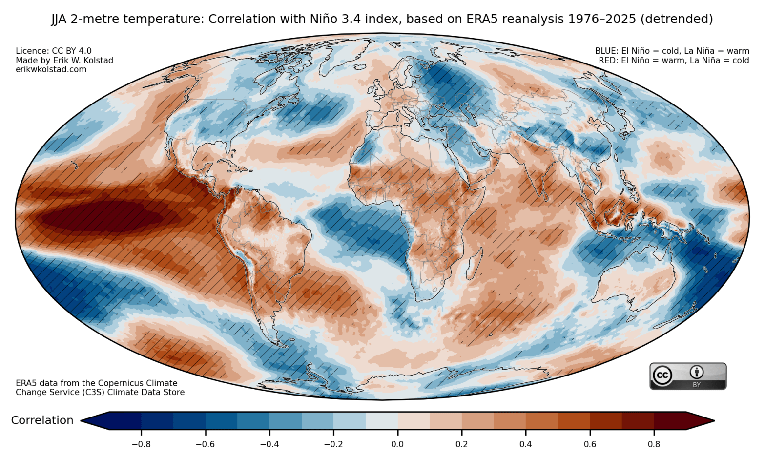
Update on 20 May 2026: Added maps for sea level pressure, thanks to a suggestion by Scott Osprey About three years ago, I made some maps illustrating the global relationships between El Niño/La Niña and temperature and precipitation. These have turned out to be quite popular, so I updated them (and added maps for seaFortsett å lese «Updated maps of El Niño/La Niña effects on temperature, rainfall, and pressure»
Taggarkiv: teleconnections
ENSO precipitation maps

We will probably soon make our way out of an unusually long La Niña episode (2 years so far). During a La Niña spell, the ocean surface is colder than normal in a large part of the eastern tropical Pacific, starting off the coast of South America and stretching far out to the open ocean.Fortsett å lese «ENSO precipitation maps»
